
Trace Virginia Beach Streets by Address
Address work in Virginia Beach starts with a parcel, not a list of people. The Virginia Beach Real Estate Property Search accepts an address or GPIN, the parcel identifier used across city systems. Its card can show the situs, or physical parcel address, owner fields, mailing city and ZIP, neighborhood, council district, land use, zoning, legal description, and map book or page. Those fields establish a current property record. They do not establish that every owner, mail recipient, applicant, or named party lives at the situs.
Write down the street number, directional word, street suffix, unit when relevant, and ZIP. Try ordinary abbreviations if the first search fails. Save the GPIN before leaving the card. It joins the assessor result to map layers and permit searches more reliably than a street label. The following sequence keeps a Virginia Beach street directory search tied to the source that actually supports each result.
- Search the full address in the assessor portal and preserve the situs, GPIN, legal description, neighborhood, council district, and map book or page.
- Open the parcel map and inspect lots that touch the target or sit directly across the public way. Keep easements, water, and large public tracts in view.
- Search the city permit system by site address or GPIN if an activity date is useful. Record applicant and contractor roles exactly as displayed.
- Use the Circuit Court Clerk’s land-record route for the current recorded instrument, then compare grantor, grantee, recording date, and legal description.
- For a dated address clue, compare reverse or criss-cross directory editions through the local-history collection instead of treating a current parcel card as a past household list.
- Use election material only through the authenticated status route or the separate statutory public-list request path. Neither is a casual street roster.
Note: A street number is a starting point, while GPIN, plat, and legal-description fields carry the stronger parcel trail.
Virginia Beach Street Directory Fields
The assessor portal is the most direct current-address tool in the Virginia Beach street directory. Address and PIN are optional autocomplete fields. A search may also be narrowed by property type, sale-date range, sale-price range, neighborhood, property use, or council district. The interface permits map display, record-card links, sorting by PIN, address, or owner, and configured exports. The inspected configuration reported a 300-result search cap and a 500-row Excel limit. Those limits describe the interface, not the number of parcels on a street.
One useful caution sits inside the result card. The FY26 and FY27 assessment headings concern assessment information, not a claim about when a person moved or when a sale occurred. A sale date must be read as a separate field. An owner name appearing on the card is also distinct from an occupant. Retain the label from the portal rather than converting an assessment result into a household conclusion.
| Portal input | How it helps on a street | Format or caution |
|---|---|---|
| PIN | Finds the GPIN when it is already known. | Autocomplete text; use the exact identifier. |
| Address | Finds the situs parcel from street terms. | Autocomplete text; choose a suggested address when offered. |
| Property Type | Separates agricultural, commercial or industrial, residential, and tax-exempt parcels. | Optional dropdown. |
| Sale Date and Sale Price | Narrows a result set by recorded sale information. | Optional ranges; dates use MM/DD/YYYY. |
| Neighborhood and Council District | Add local context to a parcel. | Optional lists; neither field proves a postal or civic boundary. |
Note: If an owner-name search is not visible in the live interface, use address or PIN rather than assuming that capability.
Virginia Beach Streets in GIS Layers
Virginia Beach Map Center links VBMap, the Historical Aerial Viewer, open GIS data, district resources, and map downloads. The parcel service behind the property viewer supports address or parcel selection, while public layers show parcel geometry, boundaries, zoning, and basemap choices. Click a parcel, then use the assessor handoff to keep the GPIN and card connected. A zoning color or a visible line gives context. It is not proof of a recorded boundary or proof of occupancy.
The Map Center view is useful when a Virginia Beach street crosses a neighborhood label, ZIP, or council district. The historical-aerial option can also reveal subdivision, shoreline, road, and parcel-context change. It does not name residents, so use it to test the location and time frame before moving to a deed, directory, or archive record.
Situs and Mailing on Virginia Beach Streets
Two address labels often appear on a parcel card. The situs is the physical parcel location. The mailing address is where tax communication goes. A mailing destination can be an agent, a business, a post-office box, or a place outside Virginia Beach. It is normal for it to differ from the situs, and it should never be recast as a statement about who is present at the property. Keep both fields only when the record itself gives them separate labels.
Several terms help when a street number changes or an old source uses a different form. A parcel is a defined piece of land tracked by the assessor. A plat is the recorded map or plan that can show lots, blocks, and boundaries. A legal description is the deed language that identifies property more durably than a street number. A criss-cross directory is a reverse directory arranged by address, often used to find a dated occupant or subscriber clue. These terms make a historical comparison more precise.
- GPIN
- The parcel identifier used to connect a Virginia Beach assessor card, map, permit, and related land references.
- Situs address
- The physical location of the parcel, used for parcel-map and site-address searches.
- Plat
- A recorded land plan used with a legal description to interpret lots and boundaries.
- Criss-cross directory
- An address-arranged directory that can provide dated, not current, household or subscriber clues.
Virginia Beach Street Record Sources
Each address-keyed source answers a limited question. The assessor card answers the current parcel and displayed owner fields. GIS helps identify adjacent geometry and civic context. Accela can show a public permit role and chronology. The Circuit Court Clerk preserves deeds, plats, mortgages, judgments, and UCC material. Dated directories and newspapers may place an address beside a name in a particular edition. Reading those sources together is more reliable than treating them as a single, current Virginia Beach street directory.
| Address record | Official keeper | Street evidence | Access channel |
|---|---|---|---|
| Assessment card | Real Estate Assessor | GPIN, owner fields, situs, mailing field, legal description, class, district, land and zoning. | Free property search; GPIN help by phone. |
| Parcel map | City GIS and Map Center | Parcel geometry, adjacent lots, boundary and zoning layers, aerial context. | VBMap, open GIS, downloads, or GIS assistance. |
| Land instrument | Virginia Beach Circuit Court Clerk | Grantor, grantee, instrument or book/page, recorded date, and legal description. | Clerk, Secure Remote Access route, mail, or counter inspection. |
| Permit record | Planning and Community Development | Site address or GPIN, record type, date, status, and documented project roles. | Public Accela search; office routing when needed. |
| Voter material | General Registrar and Virginia Department of Elections | District context, authenticated personal status, or field-limited statutory list information. | State portal, request path, local office, or mail channel. |
| Historic directory | Virginia Beach Public Library and archives | Printed street number, occupant or subscriber clues, business, and occupation by edition. | Brown Archive, digital objects, library shelves, and other repository routes. |
The access path matters too. The clerk’s current real-estate route can lead to index or image access, while older Princess Anne material may be at the Library of Virginia. The library and archive are especially useful when the need is a past address rather than a current parcel. For a name-centered confirmation after a street clue, use the narrower Virginia Beach resident lookup route instead of combining unrelated roles.
Virginia Beach Permit Records by Street
Virginia Beach Accela accepts Site Address and Parcel or GPIN searches. Its general search also includes street number, direction, street name, street type, unit, city, state, and ZIP, along with record, date, license, contact, and status controls. A public result may help date construction or alteration activity along a street. It is not a source for declaring that an applicant, contact, or contractor lived at that address.
Use an exact site address first, then the GPIN if the street form produces too many results. Preserve the record number, type, date, and status. When a message requests payment by using a real permit or property number, contact Planning and Community Development through its published phone or email rather than the message itself. Virginia Beach warned in March 2026 that impersonators were using real permit and property details in fake payment emails.
Note: A permit shows an administrative role on a project, so its name fields should stay labeled as applicant, contact, or contractor.
Princess Anne Names in Street Records
Virginia Beach is an independent city, not a current county government. That changes the normal recorder assumption. Present-day land work goes through the Virginia Beach Circuit Court Clerk, Assessor, GIS staff, and city departments. Older records can be indexed under Princess Anne County, the predecessor jurisdiction formed in 1691 and incorporated into Virginia Beach in 1963. Search both jurisdiction names before deciding that a historic street or family trail has ended.
The Library of Virginia’s Princess Anne County inventory gives that older route real depth: general deed indexes begin in 1691 and continue through successive index ranges, while court, will, electoral, church, and other books supplement the land trail. A modern street number may not appear in an early description. Compare lot, block, acreage, map book or page, and neighboring owners instead. The historical label is a search key, not a claim that a current Virginia Beach address sat within today’s city structure at every earlier date.
Virginia Beach Streets Cross Boundaries
One street can cross a ZIP, neighborhood, subdivision, postal-processing label, and council or election district. Virginia Beach has ten local election districts, and research notes that at least 13 neighborhoods are split between two districts. Use the official address-based district map, the registrar, or 311 when the line is unclear. A neighborhood name is not enough to assign every address on a street to one district.
Postal labels create a second mismatch. USPS processing examples place 23467 with 23464 processing and 23471 with 23455 processing. That is why a delivery ZIP should be verified for the complete address and never substituted for parcel geometry. Each label has a separate job.
| Label | What it can describe | What it cannot settle |
|---|---|---|
| Parcel and legal description | Land identity and recorded lot context. | Every current occupant at the address. |
| Election district | Address-based civic district context. | A whole neighborhood’s single district. |
| ZIP or postal label | Mail-routing and delivery context. | Property ownership, neighborhood boundary, or district line. |
Virginia Beach Deeds and Directories
Virginia Beach’s GIS Property Information MapServer is the public parcel-layer service behind the map view. It helps hold the GPIN and parcel geometry steady while location evidence is compared.
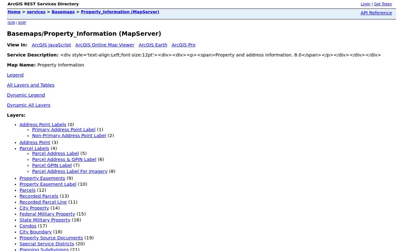
The parcel-service view supports the map side of a deed chain, but it does not replace the recorded instrument. The Circuit Court Clerk’s Real Estate Records office is the route for recorded deeds, mortgages, plats, and copies. Start with the current GPIN and legal description, then identify the current instrument and work backward from a grantee to an earlier grantor. Compare legal language and plat information at every step. The research did not identify the local online image cutoff, so the counter, mail request, and clerk guidance remain important alternatives to a web search. The clerk states that most recorded documents are public, lists copy pricing at 50 cents per page and certification at $2, and accepts mail requests with payment and a stamped return envelope. Email and fax are not the office’s channel for legal notices or official correspondence.
For a historic occupant clue, consult local directory materials edition by edition. The Edgar T. Brown Local History Archive and the public library’s local-history collection provide a different layer from land ownership. A directory entry can identify an occupant, subscriber, business, or occupation at the time of that volume. It should remain dated evidence rather than a present-tense conclusion.
Virginia Beach Street Directory Limits
No official comprehensive address-to-household roll was located for Virginia Beach. The property card is an assessment record, not an occupancy list. Permit names are tied to documented project roles. The voter status portal requires first name, last name, date of birth, last four digits of the Social Security number, locality, and a certification that the user is the voter or is authorized. The statutory voter-list route is separate and excludes protected addresses, Social Security numbers, and day and month of birth.
Protected records also matter at street level. Virginia’s Address Confidentiality Program supplies a designated address for eligible participants. Court, vital, juvenile, and certain voter information has its own restrictions. When an existing city record is not in a portal, the Virginia Beach FOIA office can receive a specific request through its published channels, but it cannot override another confidentiality statute or create an answer that no office maintains.
Lawful use. Use Virginia Beach address records for personal, lawful research and keep each record in its stated role. Virginia law prohibits stalking and other conduct meant to place a person or family in reasonable fear of harm.
Note: If a record is missing, ask the custodian whether the issue is access, indexing, conservation, or an unlocated record before drawing a conclusion.